Sunday 23 March 2014

Bletchley to Verney Junction

On a very sunny Sunday morning, I took the opportunity to take a look at the section of line between Bletchley and Verney Junction.  I started just past the point where the double track section ends and pretty much where the train in the video in my last post reversed.  I then work my way along the line to Verney Junction.  I had read elsewhere that the undergrowth that had built up on the line had been cleared and thought it worthwhile to record what is there now.
 The first bridge which gives access to some allotments.  The fencing here is relatively new and the access staircase well maintained.  The allotments can be seen to the left of the line in Bletchley flyover video.  The bridge is quite small but would still take double track.
 Same bridge from the allotments side.  It has bridge number of 4
 The next bridge is a much larger three arch construction.  The two side arches have been brick up at some stage with small arched access apertures.  The other side of the bridge is the sign that proclaims that you are entering Newton Longville.  A new station has been mooted here because of new housing development although it is not in the existing plans.  Just above the left arch is palisade fence blocking the line.
Looking back from the other side.  Again the fencing is good on the right side of the bridge with a modern access staircase but poorly maintained on the other side.  The bridge marks the boundary between the operational section and the mothballed section.
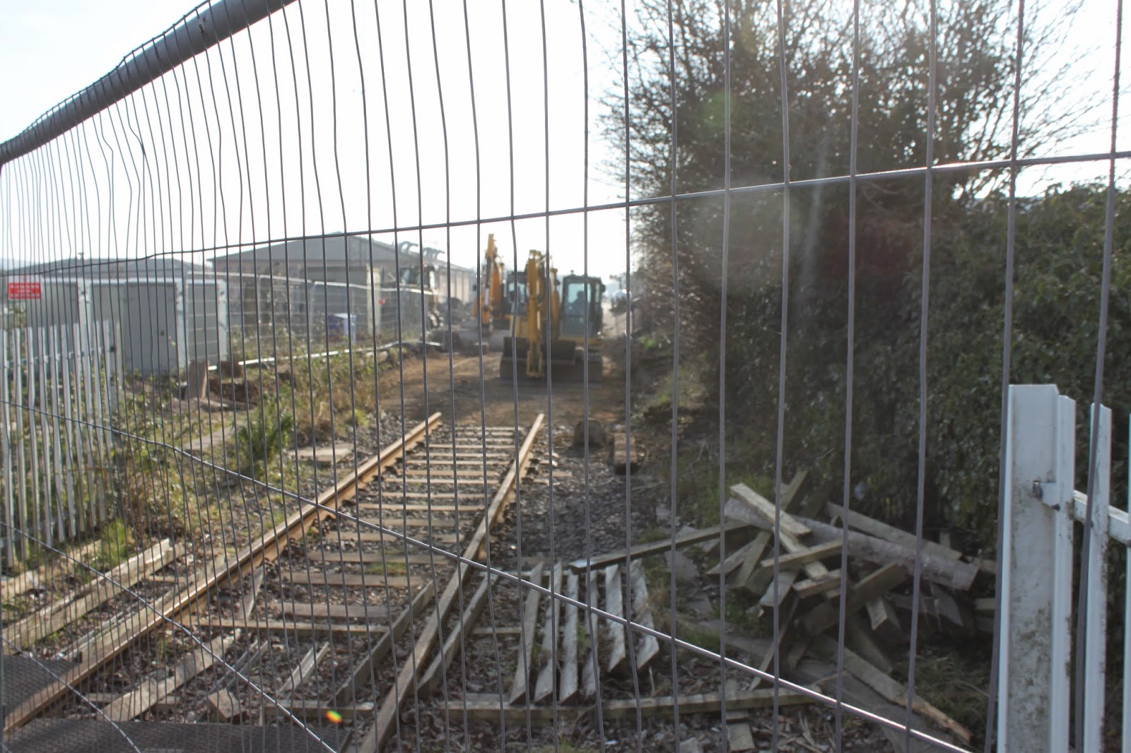
 There was an informal footpath running up from the bridge alongside the line so I managed this shot of the fence across the line without trespassing.
And this one looking west from the same spot.   Evidence of the flailing can be seen here.
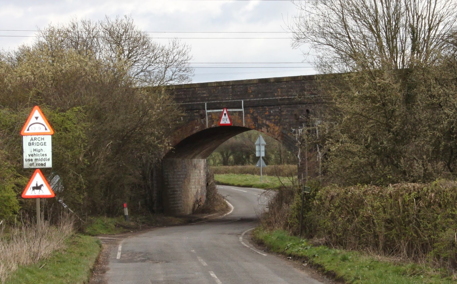
 This is taken looking east from the overbridge on Whaddon Road that runs from Newton Longville to the peculiarly named Bottle Dump roundabout on the A421. Sadly some evidence of flytipping here.  Although the track is extant it is unuseable because there is a short piece missing which you cannot see in the photo.
Now looking west from the same bridge.  A dog walker can be seen in the distance.  He is obviously not expecting a train any time soon!
 This is taken from two bridges further west from the also slightly confusingly named Whaddon Road that runs from Mursley to the A421.  I am pretty sure this is the same dog walker!
 And looking west some horse riders are taking advantage of the trackbed.  Vegetation clearance has not been carried out here yet.  The track ends at the bridge as the next picture shows.
Quite surprisingly the ordnance survey map has been updated to show this missing section of track although more is missing than the map shows.

 Now moving on to the optimistically named Station Road, this looks east.  The track resumes here.  The flail has been at work both sides of the bridge.
 Looking west from the same bridge towards Swanbourne station.
 Zooming in you can just see the end of Oxford bound platform.
The parapet brickwork is certainly in need of attention here.  It is an odd mix of red and blue bricks on this side whilst the other side is pretty much all blues.
 Looking back at the bridge from just east of Swanbourne station.
 Swanbourne station which is not going to re-open with the line. No surprise as it is not near any houses.  In fact it is nearer to Mursley and Little Horwood than Swanbourne.
 I then took at look at Winslow.  There was nothing to see in Station Road where the station site has been completely built on.  This is taken looking east from Buckingham Road.
Now looking west from the same bridge.  I believe this is where the new station will be situated.


Zooming in you can see a footbridge and Furze Lane overbridge.

 I then headed for my final destination of Verney Junction.  On the way from Winslow I passed under two substantial bridges.  This is the first no 22, a three arch bridge.
 Looking right the trackbed looks to be in good condition here.
 The next one is an impressive four arch bridge (no 24) that looks to be in very good condition. The middle arches take the road and river under the railway.
This is taken from the other side.  The guard rails look to be fairly recent additions.

Looking east across the bridge.  Trackbed has been cleared here.
 And looking west from the same spot.
Continuing on to Verney Junction the road passes through the abutments of the former line from Quainton Road which can be seen crossing the centre of the picture.  (Looking back east towards bridge 24.)
 This is the well maintained Verney Junction station house.  Now in private hands they are probably less than enamoured with the idea of a double track mainline passing their house as are the other former station building owners I am sure.
There are two features that confirm that this is a Victorian building.  The date is shown as 1870 with a V above.  Not sure whether this stands for Queen Victoria or Sir Harry Verney, the local landowner after whom this station was named.  

Zooming in reveals the second, a Victorian hole in the wall post box still in use today!
 Now moving towards the level crossing.  The portable toilet looks to be a recent addition and is probably there for the comfort of the flailers.
 The sign is interesting.  Those using the crossing seem to have a cavalier disregard to the £100 fine for not closing the gates.  Finding a local British Rail manager to notify will prove somewhat difficult!  The instruction to cross quickly is a little unnecessary when you have probably got three years until the next train!
 Looking east from the level crossing
 Looking west through the platforms of the former station which definitely will not be re-opening! I can't imagine it ever saw many passengers serving the few railway cottages that originally made up Verney Junction.
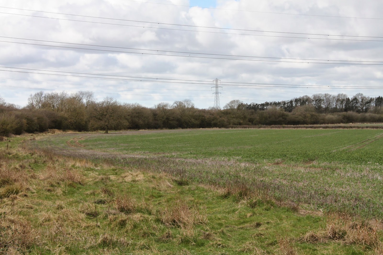
Finally the tree line seen crossing left to right is the former line from Verney Junction to Banbury.  The last remaining section from here to Buckingham closed in 1966.
I hope to cover the Verney Junction to Bicester section next.

Thursday 20 March 2014

East West Rail Videos

Just for interest, here are a few videos that show the East West route.  Some are older ones that show the route as it was and some are more recent.  None of them are my work so I am grateful to those who have made them available.

This is a very rare and interesting video that shows the Varsity line from Cambridge to Bedford just before closure.  It is possible to pick out some of the features in the Sandy Bedford section that can be seen in an earlier  post such as the station at Blunham and in Willington.  Also note the destination blind as the train leaves Cambridge.  
This one shows Sandy to Bedford as it is today. 

Now a collection of three videos that show the reinstated line over the Bletchley flyover.
First shows a cab ride from Fenny Stratford to the other side of the flyover to the end of the double track section.  Shortly after Fenny Stratford the train takes the chord which links the Varsity line to the link from the WCML up onto the flyover. It all seems to have modern signalling which indicates they were expecting more than an occasional use of the line.
Part two shows the return journey but this time taking the WCML link down towards Denbigh Junction.  Just before the point that the lines separate is reputed to be the location for the future Bletchley high level platforms.
Part three starts on the WCML south of Milton Keynes and then takes the flyover line at Denbigh Junction.  It continues to the end of the double track section , changes sides and continues to Fenny Stratford. I suspect that this was actually the first in the series.

This is a recent video of the now lifted line at Bicester town station showing an empty waste train returning from Calvert.

Finally a video that shows the line to Aylesbury from Claydon Junction to Grendon Underwood Junction.  Whilst not strictly East West, it will provide an important feeder service in the future.  As it starts the East West route can be seen on the right.  An interesting feature which can be seen at 1min 25 secs is the bridge on the right, a remnant of the former Great Central Railway which continued from here northwards across the East West line.  It then continues through the waste disposal site at Calvert to Grendon where the fast link between the GCR and the GCR alternative route via High Wycombe & Princes Risborough diverges.  It is only a stub now.

Sunday 16 March 2014

Bicester update 14th March 2014

I took the opportunity for a very quick visit to Bicester while passing on the M40 but this was a costly mistake as I got caught up in a very long delay further north!  I knew that Bicester Town station had closed on 15th February and wanted to check if work had started.  I am pleased to report that it is indeed underway and there was evidence of this from the station to the site of the new chord.  It would have been disappointing for regular users of the station if this was not the case.  The station itself is still pretty much as it was on my last visit.  It is going to replaced by a brand new twin platform station.  However the track has been removed with the exception of a short stretch straddling the level crossing. Diggers were in evidence at the station site and at Tubbs crossing.  A huge pile of ballast was being stored on the other side of the line to the station.
 First stop was at the station itself.  Looking towards the entrance, Heras fencing has closed off access to the platform.  Two small notices advise that the station is closed.
 However more information about the work and the bus replacement service is displayed on the noticeboards on the wall to the left of the approach.
A closer look at the timetable and planned work. The compatibility with the East West Rail project is noted.
 Looking through the security fencing across the platform.  I am pretty sure that the remains of the former second platform have been exposed.  The large heap of ballast can be seen in the background.
Looking west from the same spot.  The double track is still in place a short distance from here which I observed passing over the line by Bicester Village on the bypass.
  Moving round to the level crossing, this looks west towards the station.  Short section of track not yet removed.  Will go when the level crossing is reconfigured to double track I am guessing
 Now looking east.  The signal that protected the level crossing has gone.
 A better view of the trackbed.  No Heras fencing here to obscure the view.
A closer view of the platform.  A lighting rig sits on the platform which hopefully won't be needed now the longer days are coming.
 I then moved on to Tubb's Crossing where I was surprised to find a hive of activity!  The foot crossing is being replaced with a footbridge.  The crossing had been diverted to the west and this was extremely busy so photographing here was difficult.  There appeared to be drainage problems here and a large pit has been dug.  This picture looks across the pit to the original crossing site.
 Moving over the temporary crossing, this looks east.  You can just make out the Marylebone line through the "arch" of the digger on the left.
Now looking west.  The trackbed has been cleared and you can see how it was once a double track mainline railway and will become so again next year.
 Finally round to Gavray Drive where the work to constuct the new chord is being carried out.  This looks towards the future junction on the London to Birmingham line.  It would be nice to think that the row of shipping containers in the DHL yard had just arrived by rail by sadly it is not rail connected.
 A digger was working on the embankment when I arrived.  It looks as if the existing embankment is being stripped of vegetation and tree roots.
 Here is the bridge that crosses the future East West line.  No more rail delivery of material now the line has been lifted unless it is being routed via Claydon Junction which would require a reversal.  It is only an east facing junction. That will have to wait for another day.
 A large pile of earth has replaced the pile of used ballast that was here last time..
 A row of small dumper trucks parked up with one large one.  A bulldozer was working on the trackbed just behind them.
 Turning to the left, the cleared track bed.
 Judging by this van parked outside the work site, the dreaded Japanese Knotweed must have been discovered.  Provision to deal with this was made in the Evergreen 3 proposal.  Judging by the phone number, it has travelled a fair way!